NAS LEMOORE OPERATION SUPPORT CENTER
Lemoore, CA 2019 - 2020
Praxis was hired to perform a topographic survey for the design of a new operational support center at NAS Lemoore. Once the building and site improvements were designed we were brought on to complete construction staking for rough grade, building grid lines, curb, gutter, and flatwork, wet and dry utilities, and to check anchor bolts.
Control Survey | Topographic Survey | Construction Staking | Anchor Bolt Survey | Pad Certification

MORRO BAY WRF PIPELINE
Morro Bay, CA 2017 - 2020
Praxis was hired in late 2017 to provide survey services for the pipelines servicing the proposed Morro Bay Water Reclamation Facility. Preliminary boundary information for route choice was provided in the first stages of the project. In 2019, Praxis surveyors set up a survey control network that would encompass the entire route and WRF site. In addition, Praxis organized the aerial survey, set aerial panels, and performed detailed infill topographic mapping for key areas along the route. Utility research and mapping was completed as well. The boundary along the entire 3.5 mile route was located and was documented in a record of survey.
Control Survey | Aerial Mapping | Topographic Survey | S.U.E. | Boundary Survey | Legal Descriptions

SCHMIDT WATER FILTRATION PLANT
Castaic, CA 2017
Praxis provided construction staking for an addition to the Schmidt Water Filtration Plant in Castaic, CA. In addition to staking the new structure and pipelines, Praxis surveyors set a tight control network and monitored fixed points on an existing retaining wall monthly for movement during the construction process.
Control Survey | Construction Survey | Wall Monitoring Survey | DTM for GPS Machine Control

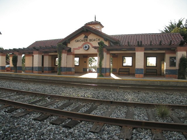
AMTRAK TRAIN STATION IMPROVEMENTS
Grover Beach, CA 2016 - 2017
The proposed parking lot expansion, station improvements, and water line extension required Praxis surveyors to perform a detailed topographic survey of the three-acre site and a half mile stretch of Hwy 1 and deliver a Civil 3D dataset including a drawing, surface, and points. In addition, we performed a boundary establishment survey of the City owned parcels, as well as the UPRR right of way, both of which control the limits of design of new parking lots and building facilities. The train station occupies parcels that were created by a map nearly one hundred years ago, and have not been resurveyed since. The boundary determination was challenging and triggered the filing of a Record of Survey map.
Control Survey | Topographic Survey & Mapping | Boundary Survey & Record of Survey Map | Set Boundary Monuments